
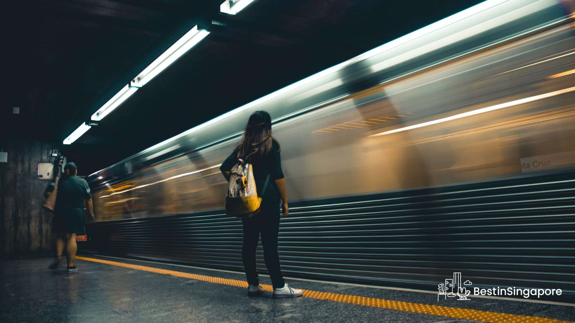
Why is Singapore MRT so good?

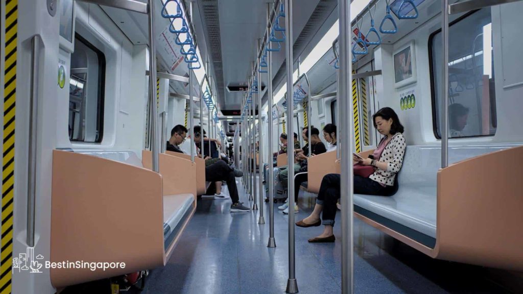
Public transportation in Singapore is one of the nation’s best features, and the highlight is undoubtedly its Mass Rapid Transit (MRT) system. I’ve traveled to a few countries myself, and I have to say that Singapore’s MRT outshines them all.
The MRT system is just comprehensive and convenient!
I can go on and on about everything related to Singapore’s MRT system, and that’s why I wrote this article. I prepared all you need to know about the MRT in Singapore so by the time you visit, you can explore the island like a pro!
All About the Singapore MRT
Singapore’s MRT system began operating in November 1987, making it the oldest metro system in Southeast Asia. Aside from that, it’s also one of the busiest and most comprehensive because it encompasses a total length of 231 km.
There are plans to expand the system—be it adding new lines or new stations to existing stations. Specifically, it’s expected that the length will be doubled to roughly 450 km by 2040.
What are the different lines of Singapore MRT?
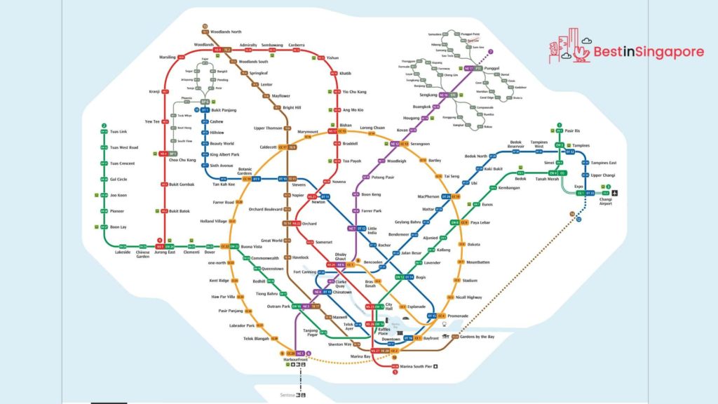
As of now, the Singapore MRT system has six lines and a total of 134 operational stations. These lines are arranged in a circle-radial topology, and they’re distinguished by their respective colors.
For more information, here are the different lines of Singapore MRT and their respective stations.
North-South Line
— From: tsuba1985
The North-South Line is the first MRT line to be built in Singapore, and it’s still one of the most utilized to this day. It’s colored red on the Singapore rail map.
This line is about 45 km long, with a total of 30 stations (two of them are infill stations). It runs from Jurong East station, which is located in the West Region, to Marina South Pier station, which is in the Central Area.
East-West Line
— From: translas_transportation_2021
The East-West Line is the second MRT station to be built in Singapore, and currently, it holds the title as the longest line in the system—with a total length of 57.2 km.
Colored green on the rail map, the East-West Line has 35 stations, running from Pasir Ris to Tuas Link. Around eight of these stations are located underground.
Take note that the Changi Airport Line (both Expo and Changi Airport stations) will be integrated into the Thomson-East Coast Line by 2040.
North East Line
— From: neliluo and agustinus05_
The plan for the North East Line came to be when congestion on roads leading to the northeast suburbs was constantly happening back in the 1980s. But it was only in 1997 that the construction began, and in 2003, the line was opened to the public.
As of now, the line has 16 stations, with some of them serving popular neighborhoods like Little India and Chinatown. The North East Line is colored purple on the rail map.
Circle Line
— From: kazamahusein
The Circle Line currently runs an incomplete loop from Dhoby Ghaut station to HarbourFront station. But by 2026, the loop will be complete once the extension from the Promenade station to HarbourFront is finished.
The interesting thing about the Circle Line is that it’s the second line in Singapore that’s completely automated and driverless. It’s also the country’s first medium-capacity line, which means that the train has a three-car configuration.
It’s colored orange on the map and has 30 stations.
Downtown Line
— From: splow2008
The Downtown Line is another medium-capacity MRT line in Singapore, and it’s about 41.9 km long, with 34 stations. These stations are all located underground, making this line the longest underground and automated rapid transit line in Singapore.
The Downtown Line is colored blue on the rail map.
Thomson-East Coast Line
— From: alkabajpai28
The Thomson-East Coast Line is the most recent line built in Singapore, and it’s also one that’s completely underground. Its length is about 43 km, and it currently has 22 stations, with more coming in the next few years.
This line’s route is a combination of north-south and east-west. It starts in the north at Woodlands town, then heads south to Orchard Road and Marina Bay, before running eastward along Kallang, and then it ends at Upper East Coast.
On the rail map, it’s colored brown.
Future Expansions
— From: bennysaik
There are still future expansions being planned for Singapore’s MRT system. Most of these expansions are just new stations added to the existing lines or changes in the route.
That said, there are two major expansions that are coming in the 2030s and 2040s. These are two new MRT lines, namely the Jurong Region and Cross Island Lines.
The Jurong Region Line was initially planned as an LRT line, but eventually, it was upgraded to a medium-capacity MRT line. It’s expected to serve the areas of the West Coast, Tengah, Choa Chu Kang, and Jurong.
Meanwhile, the Cross Island Line is planned to be the MRT line to span the island of Singapore. It will be connected to all the other major lines, so hopefully, commuting and traveling will feel even more streamlined than before.
What are the operating hours of Singapore MRT?
Generally speaking, MRT lines operate for 20 hours every day—from 5:30 am to 1 am. The only strict exceptions for this are during certain holidays and events, such as New Year’s Eve, Chinese New Year, Christmas, Deepavali, and Hari Raya.
That said, there are some rare occurrences when the MRT lines close early or open later. But these occurrences are most likely due to an unexpected event or accident, so don’t expect the operating hours to change much.
How do I buy tickets for Singapore MRT?
— From: ms.persian_rose
Unlike other countries that still use a physical ticket to ride a train, Singapore’s MRT system makes use of contactless smart cards entirely.
You have to buy an EZ-Link card, which costs S$12 (already includes a S$7 credit that you can use for train rides). You can also purchase the NETS Prepaid, which can be used to pay public transit fares and select merchants.
Once you’ve used up your credits for your card, you can top it up at these following places:
- General Ticketing Machines (GTM) at train stations
- TransitLink Kiosks located in MRT stations, bus interchanges, and integrated transport hubs
- TransitLink Ticket Offices
- Convenience stores (e.g. 7-Eleven and Cheers)
- DBS, POSB, and OCBC ATMs
- AVS Stations
If you use an EZ-Link card, you can use the EZ-Link app to top it up.
Singapore Tourist Pass
— From: kanitoma69
If you’re a tourist who’ll be staying in Singapore for a few days, then I highly suggest that you get a Singapore Tourist Pass. This pass is a special kind of EZ-Link card that provides you with unlimited travel for one, two, or three days.
You can purchase a Singapore Tourist Pass at selected TransitLink Ticket Offices, Singapore Visitors Centers, and Passenger Service Centers. These offices and centers can be found in the following stations:
- Ang Mo Kio
- Bayfront
- Bugis
- Changi Airport (Terminal 2)
- Chinatown
- City Hall
- Farrer Park
- HarborFront
- Jurong East
- Lavender
- Maxwell
- Orchard
- Raffles Place
- Somerset (Concession Card Replacement Office)
- Woodlands
What about Singapore LRT? Is it connected to MRT?
— From: temasekaperture
Looking at the tables with the various MRT stations, you might have noticed that some interchange stations are LRT stations.
This might lead you to ask a few questions: what’s an LRT station in Singapore? How is it different from MRT?
Basically, the Light Rail Transit (LRT) is a series of localized automated guideway transit systems that serve as feeder services to the MRT. In Singapore, the LRT is connected to a public housing estate to make it easier for the residents to travel.
Since the LRT isn’t intended for wide travel, there are only three lines available in Singapore: Bukit Panjang, Sengkang, and Punggol. These lines act as interchange stations to their respective MRT stations.
What makes Singapore MRT great?
Jam-Packed with Facilities
One of the best things about the MRT stations here is that they’re jam-packed with facilities. All stations have platform screen doors for your safety and lifts and climate control for your comfort.
You can even connect to the Wi-Fi, which is great if you need to stand by and work for a bit or just scroll through social media while waiting for your ride.
And of course, there are also accessibility provisions for people with disabilities. So, everyone can safely navigate the MRT station.
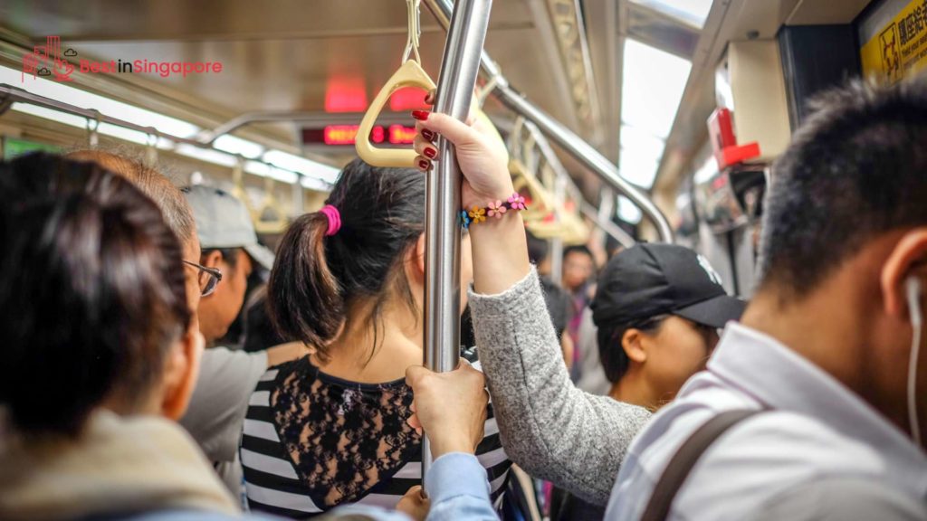
Extensive Network and Fast Trains
— From: adibmohdzain
The MRT system is quite an extensive network. There are six lines and over a hundred stations with interchange stations.
Plus, there are more lines and stations coming in the future!
Because of this, it’s easy to travel from one side of the island to another, which is great news if you really want to explore as much of Singapore as you can.
In addition to that, the MRT trains are high-speed, so you can get to your destination in no time.
There’s no need to worry about getting stuck in traffic. Now, you can just focus on visiting all the landmarks in your itinerary.
Affordable and Convenient
— From: amdg1556
Another feature that makes Singapore’s MRT system a cut above others is its affordability. Singapore is notoriously known for its high cost of living, but luckily, riding the train is quite affordable.
Aside from that, it’s just convenient to ride the MRT. The stations are strategically located, so people can easily get to them however they want—be it taking a taxi or bus to the station or simply walking.
What are some tips to consider when riding the Singapore MRT?
- Download the MyTransport.SG app. This is a mobile app developed by SMRT itself, and it’s a multi-modal journey planner. It lets you check nearby MRT stations and even send real-time traffic news.
- Make use of the charging station if needed. If you’re traveling extensively around Singapore, your phone might die before you know it. If you don’t have a power bank, just head to a station and ask the staff where the charging station is.
- When you have spare time, stop by a mall. The great thing about MRT stations is that many of them are connected to a shopping mall. Because of this, you can choose to go on a shopping spree before setting out to travel!
- Ride the train in the morning. This is a hack that tourists usually don’t know: MRT fares are cheaper (usually, the discount is about S$0.50) when you ride the train before 7:45 am on weekdays. So, take advantage of that when you can!